A full VFR flight-planning toolkit for student pilots, plus an instructor dashboard that flags a risky plan before takeoff and writes the debrief after landing.
Free to fly solo · €20/month per seat for schools · works offline in the air
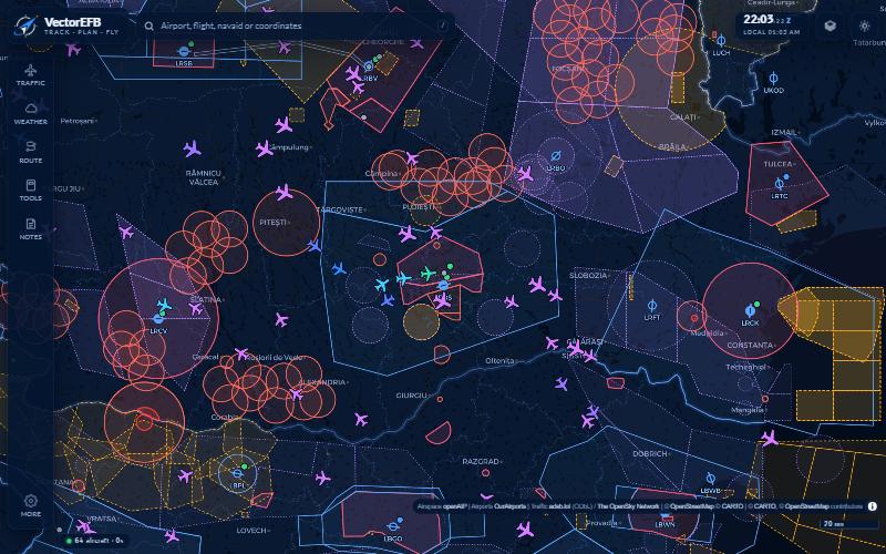
Not a moving map with a few extras bolted on — a complete pre-flight-to-debrief toolkit, in one app.
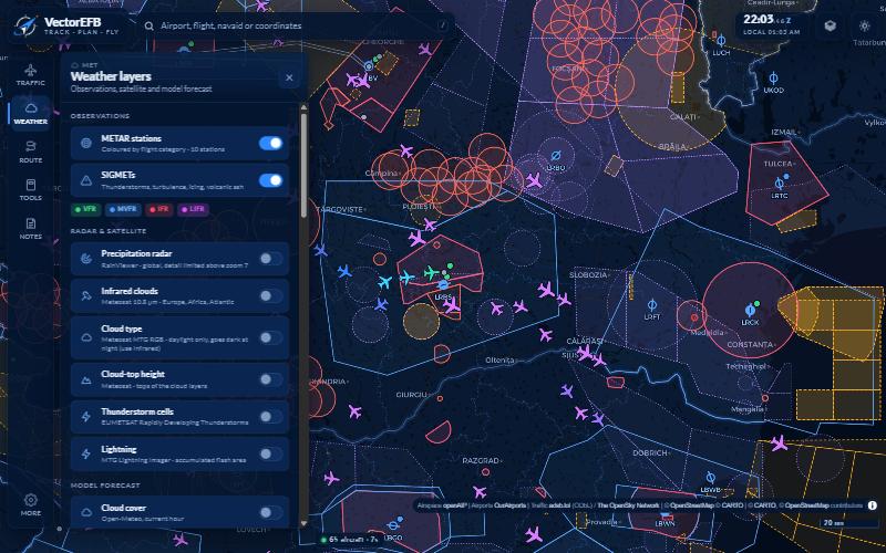
METAR stations coloured by flight category, decoded METAR/TAF, SIGMETs, precipitation radar, Meteosat infrared clouds, cloud type and top height, thunderstorm cells and lightning.
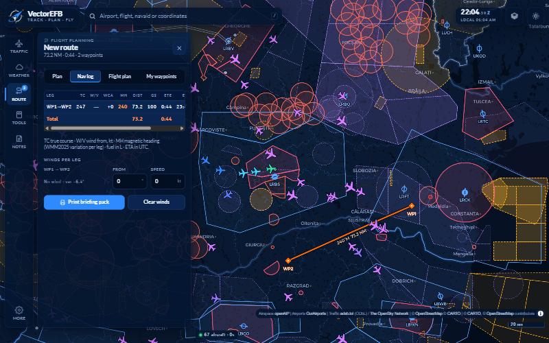
Tap-to-add waypoints snap to airports, navaids and VRPs. Forecast winds per leg, terrain and obstacle profile with a +1,000 ft clearance check, airspace-crossing warnings.
Day/night, Sentinel-2 satellite imagery, and a VFR chart with relief, hillshade, elevation grid figures and obstacles.
Live ADS-B aircraft coloured by altitude, full flight paths, radar datablocks, emergency squawk alerts, callsign search.
Airspace with vertical limits, VRPs as ICAO triangles, VOR/DME/NDB, and a tap-anywhere “what’s overhead” stack.
Airports. Live arrivals/departures built from real traffic, runway head/crosswind and favoured runway, density altitude, sunrise/sunset, frequencies, LiveATC and NOTAM links.
Tools. Holding pattern entry with wind-corrected headings drawn on the map, wind triangle, crosswind, density altitude, TAS, fuel and descent planning, weight & balance with CG envelope, unit converter.
Notes. Kneeboard templates for ATIS, CRAFT clearance, position report, departure brief and PIREP, each with a one-tap UTC stamp.
My waypoints. Long-press the map to save a point, searchable, addable to any route, exportable as GPX.
Installable & offline. Add to your home screen; the downloaded map area, nav log, calculators, notepad and flight recording all keep working with no signal.
Free to fly. Every pilot feature above is free for a student flying on their own — the €20/month seat is what a school pays for the instructor and compliance layer below.
Scheduling, per-school compliance standards, automatic flight recording, and a debrief written from measured data.
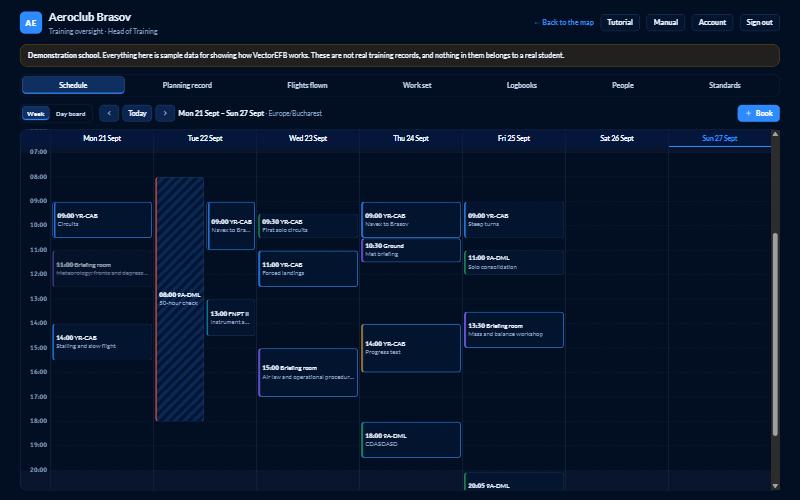
One column per aeroplane, briefing room and instructor — the ops whiteboard, digitised. The system refuses double bookings and aircraft flagged for maintenance automatically.
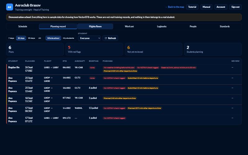
Each school sets its own minimums — reserve fuel, briefing recency, terrain clearance, how long before departure a plan must be ready. Instructors see every student’s plan flagged at a glance.
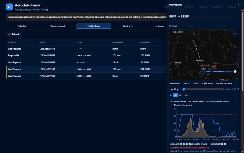
Most training aircraft carry no ADS-B Out, so the student’s own device records the track — no extra hardware. Planned vs. flown is compared automatically: distance, time, off-track, cruise level held.
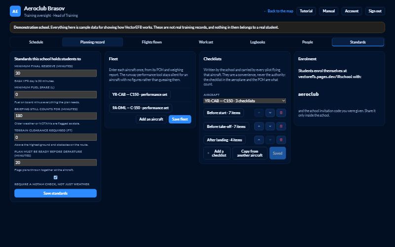
Each aircraft gets its own performance figures from its POH and weighing report, and its own checklists — before start, before take-off, after landing — written by the school.
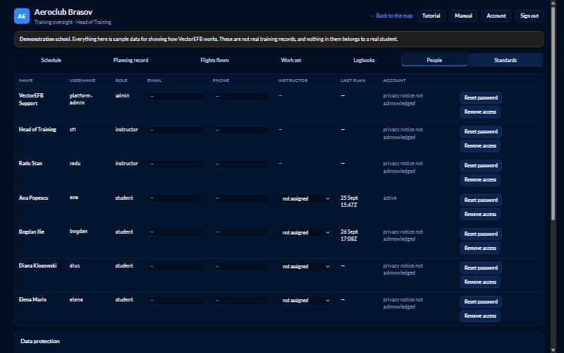
Passkeys, a linked Google account, or username and password. A platform console creates and lists schools without touching a terminal — through a visible admin account each school can see.
Students see and acknowledge what their instructor can view before anything is shared. Retention is set per school. Every person can export or delete their own account from Settings.
Portable, reference-only — AMC 20-25 Class 1 / Type A, the same category as SkyDemon, ForeFlight and Garmin Pilot. No vendor in this category claims EASA certification either.
A ready-made adoption note lets your compliance officer add one paragraph to your existing procedures — no new EASA filing required.
“For training and situational awareness only. Not certified for navigation. Always use official charts, the AIP, NOTAMs and a proper weather briefing for real flights.”
No setup fee. Billed monthly per active account.
School admin console included at no extra charge. Data licensing for the last few sources is being finalised — early-access schools onboard now, ahead of full billing.
We’ll set up your school code, load your fleet and standards, and walk your instructors through the dashboard.
Request early access →